Mohammed
Al-Zubair

Survey Engineer & Geographic Information System (GIS) & Web Designer

Intro

templatemo easy profile

What I am all about.

I am GIS enthusiastic, dedicated to be a GIS savvy, and unique Web-GIS developer. I am hopeful, passionate ,creative,full of energy and exaggerate geek by learning something new, and consistently develop my skills.

Geographic Information System (GIS) 80%
AutoCad , Surfer 9, 77%
ArcGIS,ArcGIS Online , QGIS ,Google Earth 88%
Cartography Mapping Spatial Analysis Data Analysis Imagery Analysis Map Analysis 75%
HTML5 75%
JavaSript 52%
Web Designer 70%

EDUCATION

templatemo easy profile

Sudan University of Science and Technology

Surveying & Geographic Information System (GIS)
2015- 2022
templatemo easy profile

Alison , NPTEL

Advanced Diploma In Geographic Information Systems
2021

Experience

Batman would be jealous.

Sudan Survey Authority

Trainee

I treated on how to run and how to Retrieving and exporting information from devices below

  1. GPS-TRIMBLE

  2. Total Station - Lieca

  3. Digital Level-Lieca

And I trained on how to and export data from the above devices And I also did projects Upload and sign a surveyor, transfer a benchmark and a grid budget

Jan,2019

Housing and Development Fun

Trainee

Jan,2018-Feb,2018

Courses

Click on the Course Name to
View Certificates

GIS Analyst -Basic

Sudanese creativity center , Sudan _ Khartoum

2018
GIS, Mapping, and Spatial Analysis

coursera ,University of Toronto

  1. Introduction to GIS Mapping

  2. GIS Data Acquisition and Map Design

  3. Spatial Analysis and Satellite Imagery in a GIS

  4. GIS, Mapping, and Spatial Analysis Capstone

October 11,2020
Geographic Information Systems(GIS)

coursera , University of California ,Davis

  1. Fundamentals of GIS

  2. GIS Data Formats, Design and Quality

  3. GGeospatial and Environmental Analysis

  4. Imagery, Automation, and Applications

  5.  Geospatial Analysis Project

June7,2021
Remote Sensing, QGIS And Data Import

Alison , NPTEL

May10,2021
Geospatial Big Data Visualization with Kepler GL

Coursera Project Network 

June8,2021
Maps and The Geospatial Revolution

Coursera , The Pennsylvania State University

2021
Spatial Data Science and Applications

Coursera , Yonsei University

2021
Introduction to Web Development

Coursera  , University of California 

Oct19,2020
Introduction to programming using Python

Edraak ,

Aug2,2020
International Computer Driving License - Basic

Edraak , 

Aug16,2020
Responsive Website Basics: Programming with HTML, CSS, and JavaScript

Coursera , University of London 

Oct30,2020
Web Design for Everybody: Basics of Web Development & Coding Specialization

Coursera , University of Michigan

  1. Introduction to HTML5

  2. Introduction to CSS3

  3. Interactivity with JavaScript

  4. Advanced Styling with Responsive Design

  5. Web Design for Everybody Capstone

,2021
Introduction to Data Science

Coursera , IBM  

  1. What is Data Science?

,2021
web applications for everybody

Coursera , University of Michigan

  1. Building Web Applications in PHP

,2021
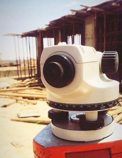
Hydrographic Cartograph

Sudanese creativity center , Sudan _ Khartoum 

2018
Safety in the Utility Industry

Coursera , University of Buffalo

Sep21,2020
AutoCAD 2D
2018

Works

I build the real value.

Portfolio Image
Hide

Extracting agricultural and residential land

Clean & Minimalistic Design

In cadastral surveying, cadastral surveying, agricultural and residential lands extraction, and area measurement for agricultural projects.

And also in many other projects .

Portfolio Image
Hide

construction

Budget & cutting and backfillingn

Constructions, buildings, weight of concrete ceilings, concrete columns, trusses, and extraction of residential lands.

Portfolio Image
Hide

Fullstack Developer

web Developer&web designer

I belatedly worked on launching the first "Khartoum Flood Mapping Platform" platform. It will be launched soon.

It included many of the work of the map designer and developers, and the project team, which consists of Engineer Mohammad Abu Obeida and Mustafa Mohammadin, participated with me.

Category: Web design

Project date: 14 March, 2022

Project URL: Mark Doe

Project URL:khartoum-flood-platform.web.app

Portfolio Image
Hide

GIS Developer &GIS Analysis

Mapping&Data Analyst

Mapping to present their findings through professional quality mapping. Conduct spatial analysis from concept to analysis and presentation to show acquired skills, everything related to computer skills, GIS program development, remote sensing and natural sciences - Participate in team and related data and information management activities.

Especially in applied fields such as geolocation and logistics. Comfortable with large database management and analysis. Strong skills with various computer systems from spreadsheets and databases to GIS mapping software such as ArcGIS and Any Software.

Portfolio Image
Hide

Cadastral signature areal

Total Station,& Level& GPS-TRIMBLE

In engineering constructions, residential plans and planning of cities and residential villages.

Top